
Features
Our reality capture rendering solutions at a glance

Premium point cloud visualization solutions
Bespoke display modes for unique insights
Joint rendering of point clouds & models

Generate appealing point cloud fly-throughs
Easily draw attention to points of interest
Promote your work on all marketing channels
Overlay point clouds with CAD drawings
Jointly view point clouds & BIM models
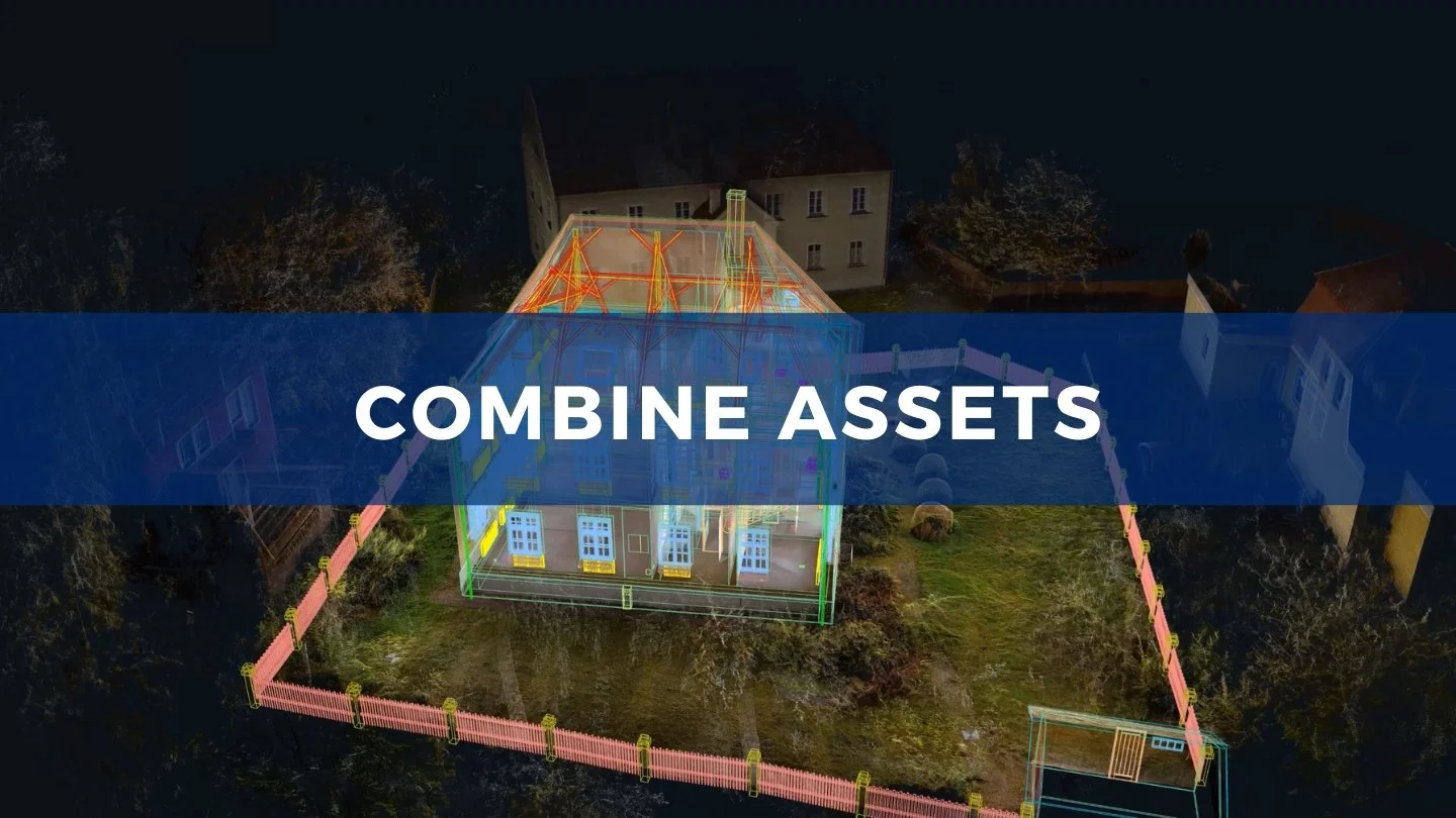
Enrich point clouds with mesh assets

Quickly capture high-resolution screenshots
High-quality orthophotos from point clouds
Export scaled & geo-referenced orthophotos

Quickly measure distances & areas
Measure on surface-like point cloud displays
Export notes & measurements as CSV files

Enrich scenes for virtual site documentation
Conveniently add multi-media annotations
Curate guided tours for virtual site exploration
FAQs
What are your system requirements?
NUBIGON is a Windows-only application. Review our system requirements.
Which point cloud file formats do you support?
E57, LAS, LAZ, RCP, RCS, XYZ, TXT, and PTS. Explore all supported file formats.
What are the best resources to get started?
Check out the getting started section of our Support Portal.
Where can I find out more about billing?
Visit our subscription FAQs.
How can I manage my license keys?
Check out our license key FAQs.
Where can I find the latest version?
Right here (sign-in required).