
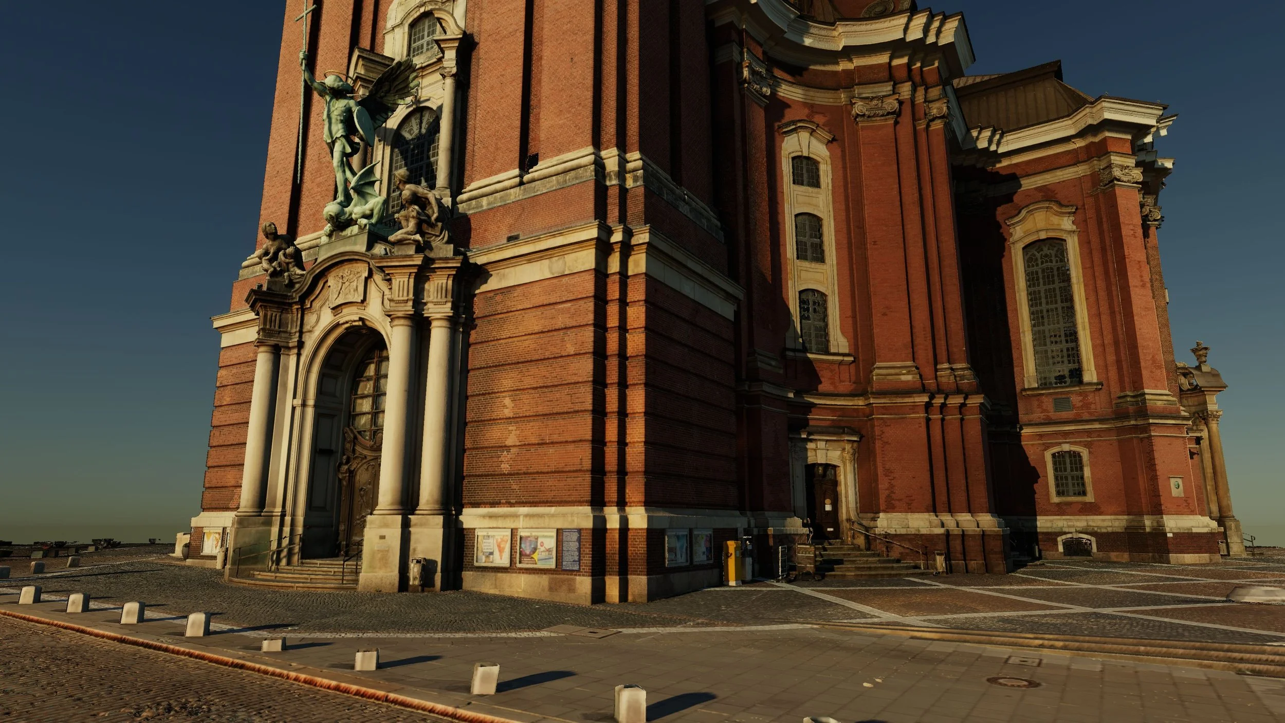
Multiple Dimensions of Reality Capture
Visualized in One Environment
Meet us at Reality Capturing Hub | Hall C5 | C5L123
-
Meet us at Reality Capturing Hub | Hall C5 | C5L123 -
Turn reality capture data into compelling project presentations.
Visualize point clouds in exceptional detail, connect reality with BIM and CAD, integrate Gaussian Splats, and explore projects under real-world sunlight and shadows.
Celebrate INTERGEO 2026 with an exclusive 20% discount on new 3-month and annual subscriptions.
4 Reasons to Get NUBIGON
#1 Make Point Clouds Presentation-Ready
Go beyond standard point rendering and present point clouds with the visual clarity your projects deserve.
NUBIGON gives you multiple ways to bring out the information that matters: from realistic Surface and X-ray rendering to intensity, elevation, and classification displays. Enhance high-quality rendering with shadows and ambient occlusion to reveal the depth, structure, and detail of your captures.
Whether you are presenting a building, an infrastructure project, a landscape, or a heritage site, turn raw scan data into visuals that are both informative and compelling.
#2 Bring BIM and Reality Capture Together
Keep BIM grounded in its real-world context.
Combine point clouds, BIM, CAD, and meshes in the same 3D scene to communicate the relationship between captured conditions and modeled geometry. Create animations that reveal points of interest while maintaining the surrounding reality capture as context.
From Scan-to-BIM and as-built documentation to construction and stakeholder presentations, turn complex hybrid datasets into presentations that are easier to explore, understand, and communicate.
#3 Put Gaussian Splats to Work in AEC
Bring the visual realism of Gaussian Splats into your reality capture and BIM workflows.
Open massive Gaussian Splat datasets and present them alongside point clouds, BIM, CAD, and meshes in the same scene. Use dynamic clip planes to create dollhouse-style presentations and move fluidly between different representations of your project.
Rather than treating Gaussian Splats as a standalone deliverable, use them as an additional visual layer to communicate the captured reality.
#4 Experience Projects Under Real-World Sunlight
See how your project site changes during the day and across seasons.
Recreate real-world sunlight and shadows based on your project's location and orientation. Explore any moment of the day and run daytime animations.
Study façade exposure, visualize changing shadow patterns across terrain and urban environments, compare seasonal lighting conditions, or present reality capture under authentic real-world daylight conditions.
Exclusive INTERGEO Offer
20% OFF on 3-Month & Annual Subscriptions
Use coupon code INTERGEO-2026 during checkout.
Offer valid through OCTOBER 15, 2026.
Choose Your Plan

For power users
Annually 899 719.2 USD
With coupon INTERGEO-2026

For specific projects
3-monthly 267 213.6 USD
With coupon INTERGEO-2026